Located in the Wildcat Ridge Wildlife Management Area, Hibernia, New
Jersey Elevation 1029 feet
Lat. 40.947074 Long. -74.472122
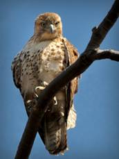
Red-tailed Hawk photo by Rick Sedivec
The
Wildcat Ridge Hawk Watch was established at this site in 1996. Formally known
as the Boonton Hawk Watch (established 1987 by Bill Gallagher), the site was
suggested for use when the Four Birds hiking trail was blazed through the
Wildcat Ridge Wildlife Management Area which is part of the Farny State Park
system. Wildcat Ridge WMA consists of 3700+ acres of deciduous forest area
initially purchased through hunting license fees. The American
Tower Company donated the hawk
watch area's original 117 acres in 1998. The area has grown to the current
acreage via acquisitions obtained by the Morris County Trust Fund, Morris Land
Conservancy, Trust For Public Land, Open Space, Green Acres and US Forestry
Service to name a few.
The
hawk watch has been visited by many political figures such as Secretary of
Interior Bruce Babbitt and Gale Norton, Governor Christine Whitman, Deputy
Secretary of the Interior Lynn Scarlett, US Congress Rodney Frelinghuysen and
US Senator Frank Lautenberg.
The
main purpose of this website is the Hawk Watch and includes some information
for other activities in the WMA. Please see the WMA Rules and Regulations page
on this website for important information regarding lawful and un-lawful acts.
The
Hawk watch is staffed by volunteers of the Wildlife Conservation Corps.,
division of New Jersey Fish and Wildlife and is a sanctioned hawk watch with
HMANA.org and the Endangered and Nongame Species Program of NJ DEP. Two annual
seasonal migration flights, Spring (February 15 thru May 15) and Fall (August
15 thru November 15) are monitored and reported to biologist and raptor
enthusiasts' on www.Hawkcount.org for analysis.
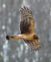
Northern Harrier photo
by Tom Gorman
Sixteen
species of raptors travel thru the Rockaway Valley Flyway during the migration
periods. Raptors are important Eco indicators. They are at the top of the food
chain, thus their health and activity are used to determine the health quality
of an environment. Â Most of the hawks
counted come from the Nova Scotia/New Brunswick area of Canada and are flying
to South America for the winter, returning in the spring to their breeding
grounds.
A
good fall flight may bring 12-15,000 hawks, and a good return flight in the
spring will bring 2-3,000. Many birds die during the migration. This is
nature's way of only allowing the strongest hawks to breed.
The
hawk watch is conducted from a rock outcrop. The view from the hawk watch is
southeast toward Manhattan, NY. across the New Jersey coastal plain. Visibility
up to thirty miles is possible. On clear days a person can see all the way to
the George Washington Bridge in Fort Lee, the Empire State Building steeple,
lower Manhattan and sites along the
Watchung Mountains as well as local locations such as The Tourne Mountain in
Boonton. This location is ideal for the migration flyway due to the updrafts
from the valley and the unobstructed distant view.
You
must hike approximately 1 mile up to the hawk watch. The most direct routes are
either the tower gravel road or Orange Flyway.
There are blazed and non-blazed trails throughout the WMA. The blazed hiking trails were built by volunteers, and by hiking them you can see and learn the history of the area.
The Four Birds, white blazed trail, is the main trail of the trail network in the area and is approx. 21 miles in length. The southern trail head is located by the bat Hercaberium, the largest bat cave in New Jersey, located off Green Pond Road in Hibernia. The mid section follows the western shore of Split Rock Reservoir. Hiking passes are required north of Split Rock Reservoir from the Newark Water Shed. The trail crosses Green Pond Road continuing north to the New Foundland trailhead near Route 23.
The Orange Flyway, orange blazed trail, is approx. one mile in length and parallels the primitive Tower Road. Trail heads are located at the hawk watch parking lot, located at the end of Upper Hibernia Road, and at the hawk watch.
The
Beaver Pond Trail, red blazed trail, has a trail head in the first parking area
off of Brunache Road. The trail passes
through the old mining area where structures can still be observed, and joins
the Four Birds Trail.
The
Split Rock Loop trail, blue blazed, southern most trailhead is located off the
Four Birds Trail. The trail runs along the eastern side of Split Rock Reservoir
to the northern trailhead junction at the Four Birds Trail.
Graffiti
Cliffs trail, yellow blaze, joins with the Four Birds Trail and ends at the
cliffs edge.
Primitive
roads are fire roads and used for maintenance. The area was originally a mining
town, mining iron ore. The remains of foundations and building can still be
seen along many of the trails.
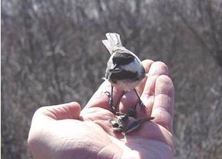
Chickadee
photo and hand Rick Sedivec
The
most common visitor to the hawk watch are the local chickadees and titmouse.
There are a variety of other species as well throughout the WMA. However, the
chickadees have become accustomed to the activity at the hawk watch and will
readily except sunflower seeds and un-processed peanuts from you.